

Makaleler
29
Tümü (29)
SCI-E, SSCI, AHCI (7)
SCI-E, SSCI, AHCI, ESCI (9)
ESCI (2)
Scopus (13)
TRDizin (9)
Diğer Yayınlar (7)
1. Spatiotemporal drought analysis and future risk assessment using multi-index remote sensing approach and hybrid trend-based prediction modeling
ENVIRONMENTAL MONITORING AND ASSESSMENT AN INTERNATIONAL JOURNAL DEVOTED TO PROGRESS IN THE USE OF MONITORING DATA IN ASSESSING ENVIRONMENTAL RISKS TO MAN AND THE ENVIRONMENT
, cilt.1, sa.198, ss.1-37, 2026 (SCI-Expanded, Scopus)


5. Predicting Winter Wheat Yield using Landsat 8-9 Based Vegetation Indices in Semi-Arid Regions
International Journal of Environment and Geoinformatics
, cilt.12, sa.2, ss.45-57, 2025 (Hakemli Dergi)
6. Çanakkale İlinin Kentsel Alan Değişiminin SLEUTH Model ile Analizi
Afyon Kocatepe Üniversitesi Fen ve Mühendislik Bilimleri Dergisi
, cilt.24, sa.05, ss.1207-1215, 2024 (Hakemli Dergi)


13. Automatic Construction of a Knowledge Base for Transport Networks
Advanced GIS
, cilt.2, sa.1, ss.8-17, 2022 (Hakemli Dergi)
15. Açık Maden Ocağının Fotogrametrik Yöntem ile Geometrik ve Spektral Analizi: Bigadiç Bor Maden İşletmesi Örneği
Afyon Kocatepe Üniversitesi Fen ve Mühendislik Bilimleri Dergisi
, cilt.22, sa.1, ss.175-186, 2022 (Hakemli Dergi)
Hakemli Bilimsel Toplantılarda Yayımlanmış Bildiriler
65
6. Beton dayanımının fotogrametrik analizi
5. Uluslararası Bölgesel Kalkınmada Üniversitelerin Rolü Trakya'nın Geleceği Sempozyumu, Çanakkale, Türkiye, 12 Mayıs 2022, ss.9, (Özet Bildiri)
46. Effect of Climatic Change on Guzelyalı Landslides, NW Canakkale, Turkey
17th International Symposium on Environmental Pollution and its Impact on Life in the Mediterranean Region, İstanbul, Türkiye, 28 Eylül - 01 Ekim 2013, ss.1, (Özet Bildiri)
51. Determining the geochemical characteristics of geothermal resources and generating a geothermal information system of thermal waters in Biga Peninsula, NW Turkey
245th National Spring Meeting of the American-Chemical-Society (ACS), Louisiana, Amerika Birleşik Devletleri, 7 - 11 Nisan 2013, cilt.245, (Özet Bildiri)

Metrikler
Yayın
127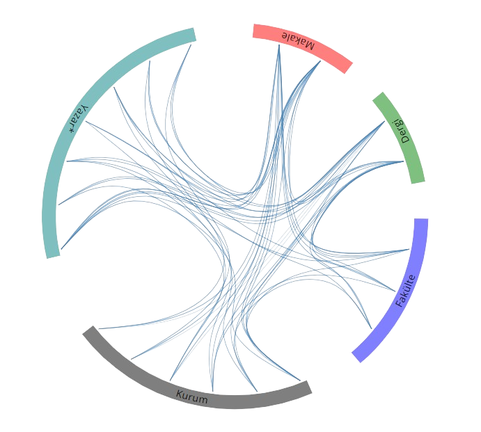
Açık Erişim
20
BM Sürdürülebilir Kalkınma Amaçları